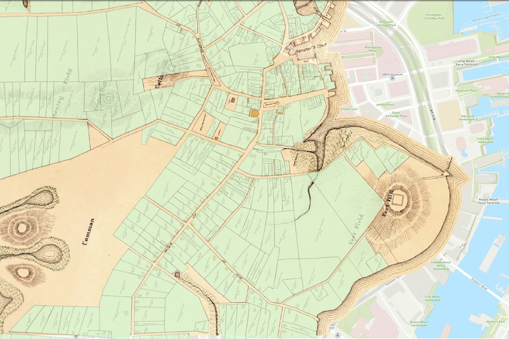
Northeastern University history professor Chris Parsons digitizes historical records of the people and places in Boston, Massachusetts, before the Revolutionary War

While much of humanity is busy using FaceApp to see how they’d look in the future, other people are trying to look into the past. But when a city’s history isn’t well documented or organized, it can feel almost as imaginary.

When Chris Parsons, an associate professor of history at Northeastern, asked students to locate an old church, they all ended up in different places. Through the Birth of Boston project, he’s making the city’s life and culture more prominent in public memory—and its landmarks easier to find. Photo by Brooks Canaday/Northeastern University
Chris Parsons, an associate professor of history at Northeastern, knows this firsthand. When he asked his students to locate the first church in Boston, Massachusetts, they all ended up in different places.
According to Parsons, this is because public historians have placed more emphasis on the Revolutionary War than on the founding of the place where it started, a city with a rich history but a lack of signage to show it. It was this that motivated Parsons to begin The Birth of Boston, a project that reintroduces long-forgotten people and stories into the historical landscape.
The emphasis on Boston’s Revolutionary War history is understandable; learning about conflicts is integral to understanding the history of a place. But trying to also learn about cultural traditions, legal scuffles, or the kinds of jobs people held? Parsons says it is just as vital to understanding the past—and should be much easier.
The Birth of Boston allows people to look beyond the limited number of events captured in public memory via plaques and statues. By using an interactive map, users can learn who lived where, what they did, and even, in some cases, if they were accused of being witches.
“Who were the people that founded Boston?” asks Parsons. “And not just the governors or the priests, but the people who owned pubs, the people who were enslaved, the people who worked on the docks—the less visible people?”
In the 19th and 20th centuries, a few curious people had the same questions. According to Parsons, one woman named Anne Haven Thwing “went a little overboard”: She filled 60,000 index cards with the addresses and names of almost two hundred years’ worth of Boston residents.
“She wanted to know where her ancestors lived,” Parsons says, “and so to do that she tried to locate where everyone lived.”
Molly Nebiolo and Matthew Bowser, two graduate students of history at Northeastern who are working with Parsons, helped comb through Thwing’s records. Collectively, they overlaid this information on a map created by another curious, independent historian, Samuel Clough, bringing together what were once disparate efforts to take stock of a city.
Parsons also worked with colleagues at the Massachusetts Historical Society; the NULab for Texts, Maps, and Networks; and the Northeastern library’s Digital Scholarship Group, including Bahare Sanaie-Movahed, who specializes in geographical data.
Together, historians and tech wizards have picked up where curious Bostonians left off, digitizing the lives of their predecessors and, in doing so, giving them prominence alongside better-known markers and monuments.
“I think that’s one of the things that will make this kind of fuzzier, harder-to-interpret historical data more useful for the public,” Parsons says.
And in a city founded a century and a half before the Boston Tea Party was even an idea, there are a lot of data still to share.
For media inquiries, please contact media@northeastern.edu.


